

Miles of pristine, dune-fringed beaches and secluded coves hug the Northumberland coastline yet many are deserted says Sarah Banks. Some of the hidden beaches require a longer walk-in, like those on Holy Island, which only adds to the pleasure in discovering them.
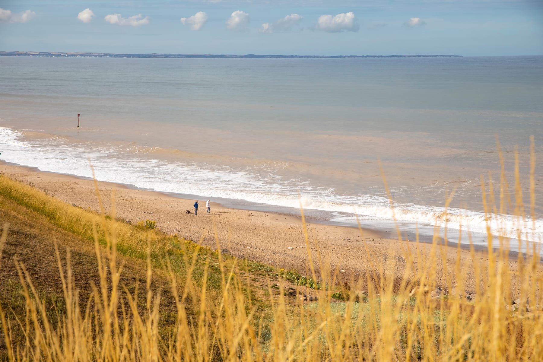
Yorkshire’s sandy beaches are interspersed with charming fishing villages that cling to the rugged cliffs. Between these you will find coves, many only accessible by a steep clamber down or with the help of a rope, such as Port Mulgrave. On Durham’s Heritage Coast the secluded cove of Hawthorn Hive is reached through an ancient wooded dene. One of the most enjoyable ways of discovering these beaches is by walking the coastal paths. You will be rewarded with spectacular coastal scenery and the chance to spot seals, dolphins and porpoises; you can also scramble down to your own secret cove. Check tide times before heading out as some beaches are best accessed, or are only accessible, during low tide. And remember – these beaches do not have lifeguards, so take care with rip currents and rocks.
TEES VALLEY & COAST
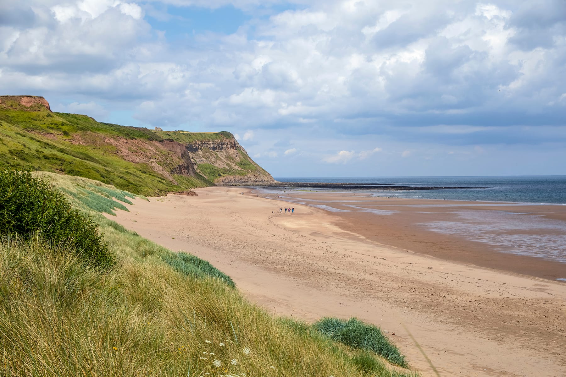
CATTERSTY SANDS - Wide, unspoilt golden expanse of sand and little-known bay, sheltered behind high cliffs and grassy dunes. One of the most beautiful beaches along this coastline, cherished by locals. DIRECTIONS From Staithes follow the A174 for 5 miles, then turn R onto Mill Lane to Skinningrove. Find parking in village. Beach is straight ahead. Cleveland Ironstone Mining Museum is here with haunted tunnel tours. Beach is on far side of jetty. 5 mins
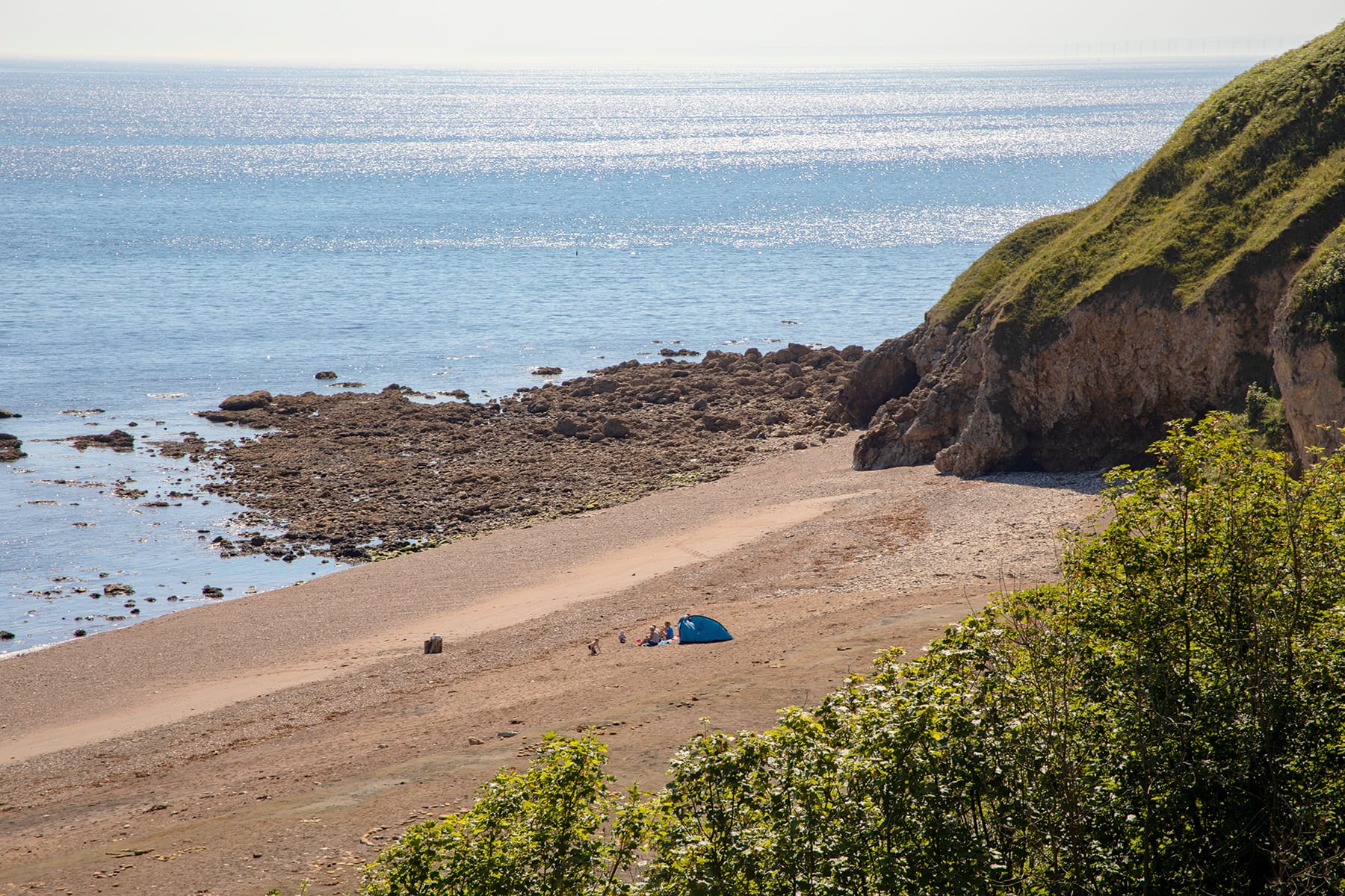
PORT MULGRAVE - Fascinating small sand and rock beach with an end-of-time atmosphere. This once thriving port was used for shipping ironstone to Jarrow on Tyneside. Rustic beach shacks built by local fishermen sit under precarious cliffs, and the remains of its industrial past are scattered among the rocks. DIRECTIONS Turn R off the A174 in Hinderwell, signed ‘Port Mulgrave’. Parking at end of road on cliff (TS13 5LH) after 1 mile. Very steep and tricky descent via a rope. Sandiest at N end near old pier. 10 mins
HOLDERNESS & SPURN HEAD
MAPPLETON SANDS - A lovely stretch of sand and shingle beach between two granite rock breakwaters, tucked away in a cute, timeless village with a small café for refreshments. DIRECTIONS Follow the B1242 from Hornsea for 2½ miles to Mappleton. Take L onto Cliff Ln to car parking at end on R. 3 min
FLAMBOROUGH & EAST WOLDS
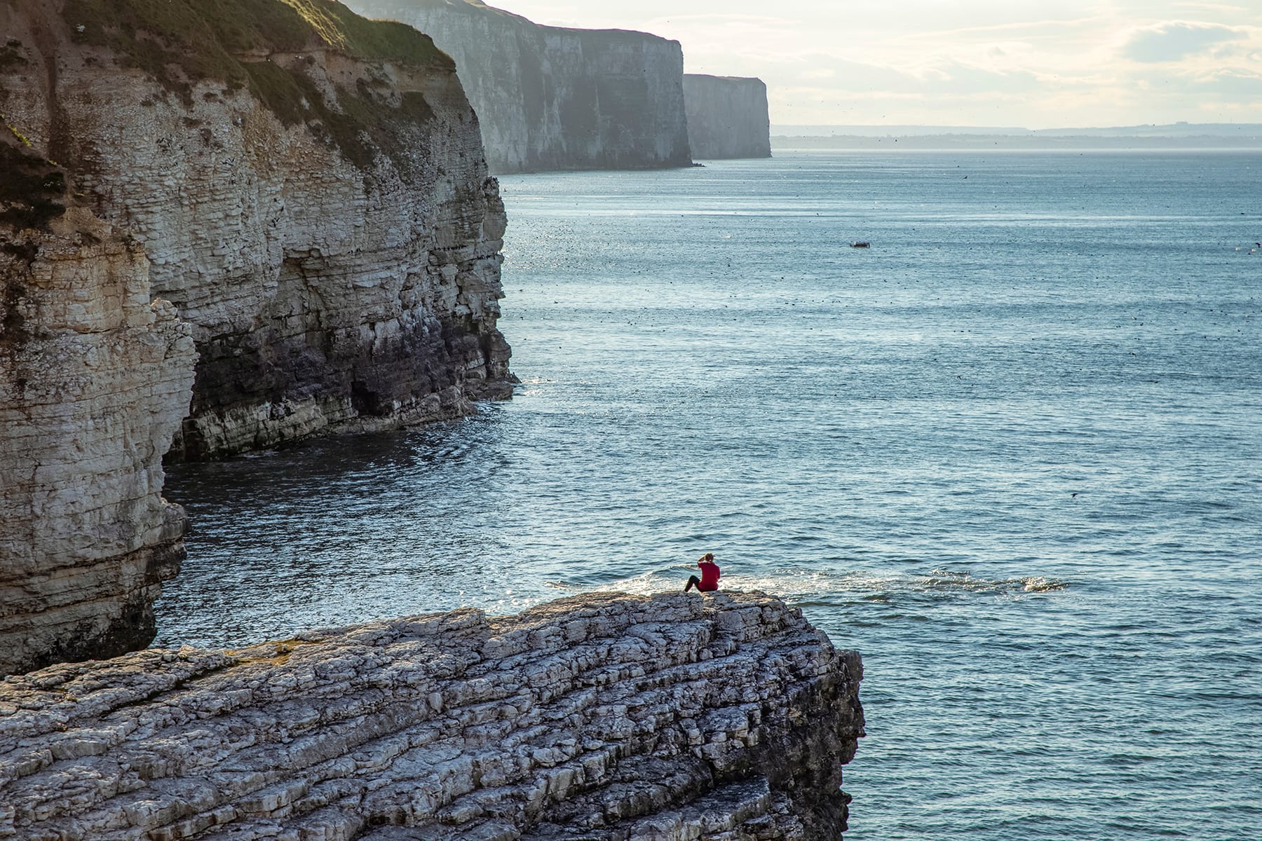
THORNWICK BAY, FLAMBOROUGH - Shingle and pebble cove beneath magnificent chalk cliffs with smugglers’ caves to explore by kayak or paddleboard. At LT, walk round to Little Thornwick Bay to find a spectacular natural amphitheatre and ‘rapids’ to swim through. Plenty of rock pools. Thornwick Bay Café serves basic snacks. Open summer, Mon – Fri 10.30am – 6pm; spring/autumn, Mon – Fri 11am – 5pm. Every weekend 10am – 6pm, except winter. DIRECTIONS From Flamborough village, follow the B1255 on North Marine Road. After ½ mile take L, signposted ‘Thornwick Bay’. Pass parking kiosk (£1.50 all day). Continue 300m to clifftop parking. If you plan on staying late, move car outside barrier before 6pm. 2 min
ALNWICK & EMBLETON BAY
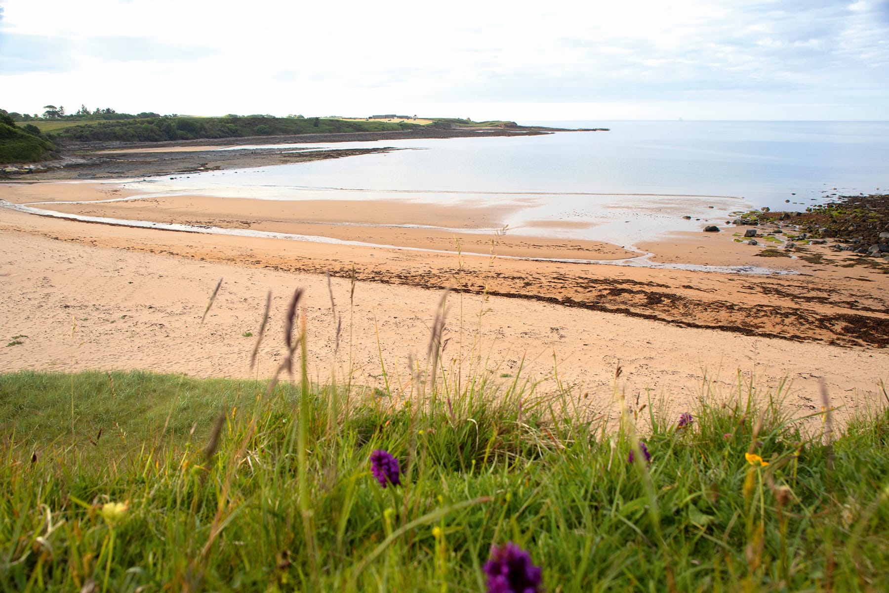
SUGAR SANDS - Sheltered and secluded sandy beach, one of several pretty coves along this stretch of the coast. DIRECTIONS From Longhoughton, turn R opp church and continue for ½ mile to Low Stead Farm. Continue through farm to car park; honesty box for parking. If closed there is a small parking area in front of gate. Alternatively, park at Boulmer beach car park and walk N on coastal path for 600m. Alternatively, access via coastal path S of Howick. 5 mins
RUMBLING KERN - Hidden sandy cove and thrilling coasteering spot with leaps and jumps from a series of vertical sandstone walls, as well as stacks and caves to swim through. Fascinating geological features. DIRECTIONS From the Alnwick bypass (A1) take the B1340 turn-off at Denwick and follow signs to Longhoughton. At Longhoughton follow the B1339 N and after 1 mile turn R towards Howick to parking at Sea Houses Farm, where the road turns sharp L along the coast. Follow farm track just N of the farm to the cove. 5 mins
DURHAM & COAST
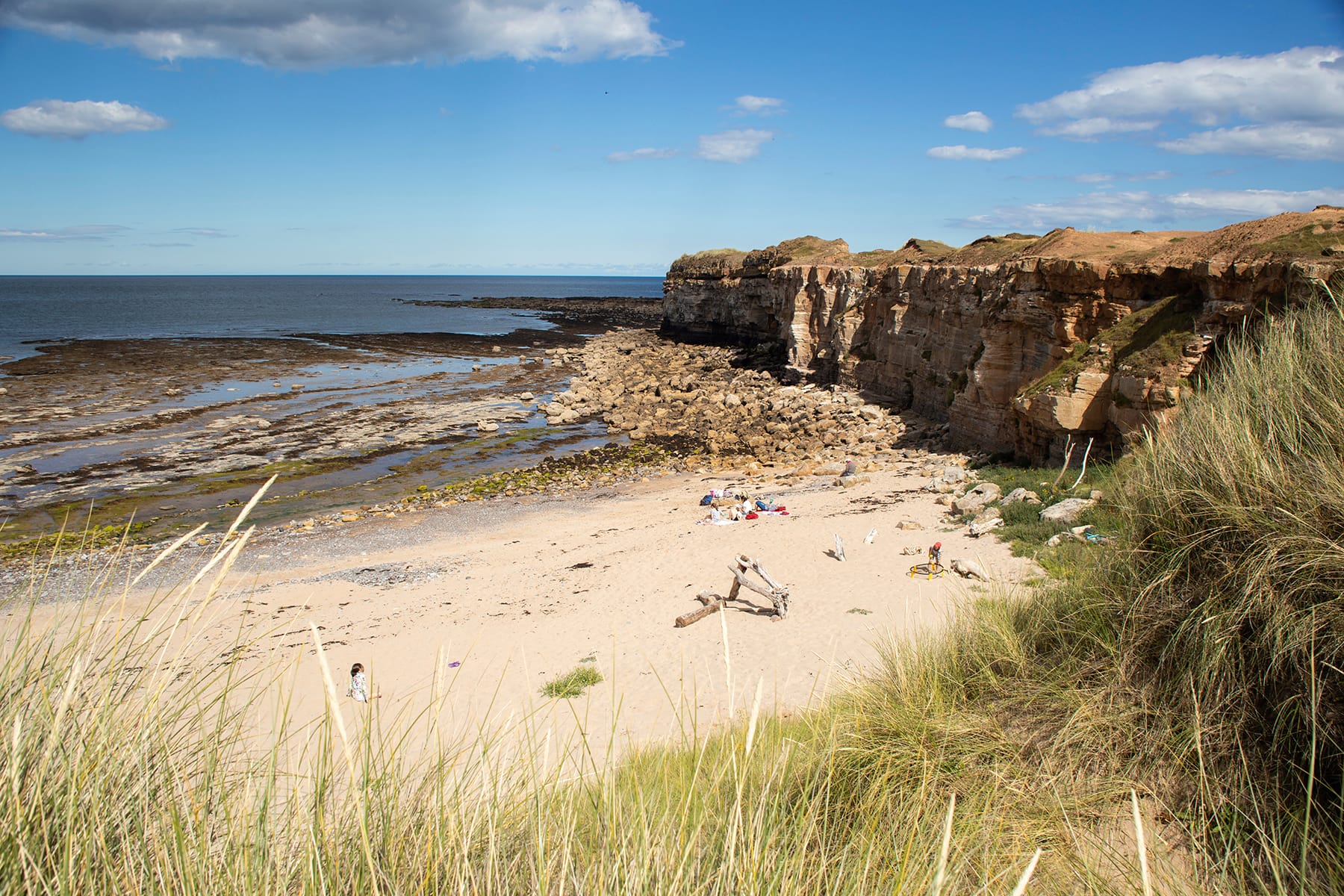
HAWTHORN HIVE - A remote sand and shingle bay at the end of a steep-sided coastal dene reached via paths through ancient woodland and hay meadows. Care with kids as beach shelves quickly. DIRECTIONS Head S from Seaham on the B1432 and turn L signed ‘Hawthorn’. Continue to road end and parking by bungalow. Go through metal gate signed ‘Hawthorn Dene’, following track above dene. At end of track turn R through meadows then L, crossing railway track to steps down to beach. 30 mins
NORTHERN BORDERS
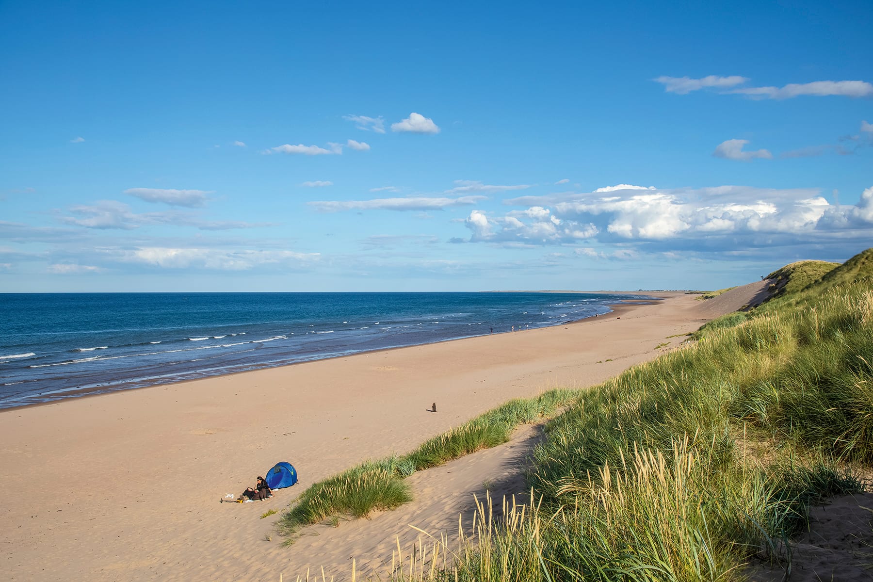
CHESWICK SANDS - A magnificent dunebacked sandy beach that stretches for miles with views towards Berwick to the north and a perfect vista of Holy Island to the south. DIRECTIONS Heading N on A1, after Haggerston, take a R signposted for Cheswick and continue for about ½ mile. Take R after sharp bend then take next L. Continue through village and over railway bridge to parking area on L and beach. 2 mins
ROSS BACK SANDS - A spectacular, remote sandy beach and dunes, with Lindisfarne Castle at one end and Bamburgh at the other. Often deserted, this is a contender for Northumberland’s most wild and beautiful beach. DIRECTIONS Heading N on A1, turn R after Belford, signed ‘Warren Mill’. Turn L at T-junction, signed ‘Easington’, then R, signed ‘Ross’, and park on verge before Ross Farm (NE70 7EN S/c cottages). Continue a mile on foot along lane and through dunes. Budle Bay sands and nature reserve are a mile to the south. 20 mins
COVES HAVEN - Situated at the far north of Holy Island, this beautiful, remote sandy beach is backed by high dunes, with cliffs at the eastern end. On our visit we spotted deer scampering through the dunes. Rock pools at LT. Often overlooked by visitors. DIRECTIONS Heading N on A1, turn R, signposted ‘Holy Island’, and continue 3 miles across tidal causeway to main car park before village. Turn L and L again out of parking, following unsigned lane to farm buildings then farm track N, keeping straight for 1 mile. At field end, head N onto dunes to Coves Haven. 30 mins
Sarah is an author, photographer and journalist, living in Ryedale, North Yorkshire
More Inspiration
READ Wild Guide to North East England by Wild Things Publishing


